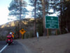
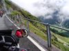
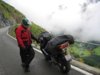
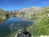
Jasper National Park
Attachments
-
 124.9 KB Views: 16


Unfortunately no, where is this?Looks familiar.
It is the same scene that Moto-Charlie posted #257Unfortunately no, where is this?
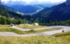
Washington and Oregon are chock full of hidden gems like that. One of my favourite areas to ride!!Maryhill Loops Road, Washington. https://www.maryhillmuseum.org/outside/historic-maryhill-loops-road
I shredded the sides of my tires on this road...
Make that post #527It is the same scene that Moto-Charlie posted #257
Sometimes I wix my mords up. Seems it happens with srebmun as well.Make that post #527
")

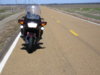
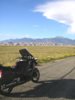
I was on west bound on Rt 89 in Montana coming into Great Falls and If you stand on the foot pegs you can see across the whole state.https://www.google.com/maps/@47.4307272,-110.9837271,3a,75y,305.76h,112.16t/data=!3m6!1e1!3m4!1sBH0PPt2xY-U3OkqKEzj_9g!2e0!7i13312!8i6656Time to start planning another ride across the Great Plains. I'm missing seeing miles and miles of green fields! Here are two photos of Washita Battlefield and the last is lunch in Dodge City, highly recommend eating a steak. Washita was the first and only victory George Custer had over the natives by slaughtering them in their sleep. The tactics he used didn't work at Little Bighorn and illustrates his recklessness that shown through out his career. Following Custer's Trail is an interesting motorcycle ride.