I'm thinking about a DR in addition to my ST. What's your evaluation of the bike so far?
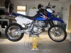
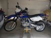
I love it. Does exactly what I want so far. My KLR was getting a bit heavy. Here take a look at this right up I did a few weeks back. And yes I am on the DRriders Forum. Great info.
Recon Dual Sport ride for Ruedi Res. Get togeather
So, Monday the weather was picture perfect, near 80 degrees and todayit is snowing.
I decided to take the DR650 out and do a scouting ride of the route that I plan on taking to the Ruedi Reservoir NT700 get together. I knew that I was only going to get a portion of the route scouted, as I estimate it will take two days to get from my house on the east side of Denver Metro Area to the Reservoir. One does not want to cross the 4x4 passes at nearly 14000 ft. any time after three PM. in the afternoon. I have three major Dirt Passes planned. And one paved pass.The first being a relative nontechnical pass, Boreas Pass. @ 11,481 ft. Timing wise we should reach this about mid-morning. The second pass is Mosquito Pass @ 13,986 ft. east of Leadville. This Pass would be done in early afternoon. With the night spent in Leadville, in a motel or camping at Turquoise Lake. Then the next morning ascend Hagerman Pass @ 11,925 ft. The paved pass is Hoosier pass @11539 ft) Not a big deal. There are also some alternate routes around the passes in case of snow pack or inability to get over them, or just running out of time. Of course I have not scouted those alternate routes yet. Any way I was stopped by the snow line at about 10,500 ft on the approach to Boreas Pass, Just past Como, CO.
The route that I rode took me from Sedalia over Rampart Range down to the South Plate rive and then on to the Deckers Store. (HI way 67) This is one of my favorites rides as there are plenty of paved twisty going over Rampart and down to Sprucewood. From there the road turns to a graded gravel/dirt road of three miles to the down to the river. (County Rd 40) There is a mile of 15% grade which for fist timers, is quite interesting to see their face expression. “You want me to do What?”Once at the river it is ten more miles to the Deckers Store, beautiful early morning ride. Stopping at the store for a cup of coffee and then continuing on the pavement for a couple of mile to the turn off to Goose Creek Rd. (Forrest Service road 211)20 miles of dirt across the Hyman Fire burn area of 2003. Still beautiful in its own right but a real shame. This road twists and turns, ups and downs, over to Terryall Reservation Road. Then we hit pavement which need serious work. (County Rd 77) Well CDOT is rebuilding this road so I had 9 miles of pilot car following. Good thing I was on a DS bike as the road was all ripped up until the new pavement at Terryall Reservoir. A few minutes fooling around the Reservoir and then blasting north on beautiful new pavement for a few more miles until I came to Packer Rd. (County Rd 34) 6 more miles of dirt, smooth and fast , to intersect with Highway 285. We are now in what is called South Park. A high Plateau that crosses over to the Pike-San Isabel Nat. Forrest and the Mosquito mountain Range. Turning left on 285 I head a a few mils to the turn off to Como. And start looking for Forrest Service Road 33 which takes me over Boreas Pass into Breckenridge. Well here at the 10,500ft. mark, I had to turn around as the road got too muddy and snowy for my liking. I knew that I was not going to get over this pass today. Not to mention the others. Much too early in the year. And with the snow that the High Country has been getting this spring, the end of June might also be a challenge.
http://goo.gl/maps/LbgcC
Attached Thumbnails