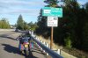
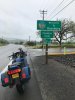
They were two different trips. The trip to Enterprise was as we were making our way to Glacier NP. We rode on Hwy's 22, 26 & 7 to Baker City and then back roads thru North Power, Union, Cove, Alicel and Hwy 82 into Enterprise. After Enterprise we headed north on Hwy 3 to Lewiston, ID.Was that the same trip as the Enterprise photo? What route did you take out there? Out to Imnaha and back? I was exploring out there and got as far as Hess Rd. north of homestead intending to take it to Joseph but decided I need a better adventure bike. I headed back to Baker city and Garmin suggested take a gravel road toward Cornucopia but I'm glad I passed on that one.
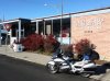
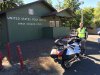
On the Imnaha trip, I came from north of Pendleton on Hwy 11 & 204 dropping into Elgin then after Imnaha I rode along Hells Canyon and came out just east of Halfway at Hwy 86 before riding into Baker City.