
You are using an out of date browser. It may not display this or other websites correctly.
You should upgrade or use an alternative browser.
You should upgrade or use an alternative browser.
New Scenic Photo Contest
- Thread starter Mellow
- Start date


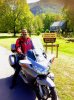
On 33 westbound heading to Seneca Rocks, WV. .
Speaking of Seneca Rocks....
Attachments
Beloit To Waupun http://www.gmap-pedometer.com/?r=5814929
This route takes you along the whole Rock River Trail in Wisconsin, from the Illinois-Wisconsin state line at Beloit to Waupun County Park in Fond du Lac County.
Length: 148.1 mi
I STumbled across AN Eagle's nest here in Ixonia! He was right by the side of the road...Watched him circling for a few minutes, and a car pulls up...I pointed to the Eagle...He said "yeah...there's 2 of them, and they have a nest in that tree over there! They showed up last year, and returned this Spring."
43°09'31.6"N 88°34'36.8"W (eagles Nest)
Attachments
Taking advantage of the unexpected nice weather to get the bike out in my own backyard.....

Tioga Bridge Wayside

Colliding Rivers Wayside, Glide, OR

Tioga Bridge Wayside
Colliding Rivers Wayside, Glide, OR
Last edited:


Near West Yellowstone

Beartooth Pass

Lolo Pass
All within a days ride of my house
Last edited by a moderator:
Near West Yellowstone
Beartooth Pass
Lolo Pass
All within a days ride of my house
Lucky! Great pics.
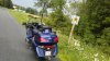
Somewhere on old state route 55 in West Virginia, heading back from Seneca Rocks toward Moorefield, WV

Sent from my SM-G955U using Tapatalk
Looks best
") when the bikes in there.
when the bikes in there.How do I get some of those lights on my bike?
Here is how mone are set up. With mine you unfortunately have to cut part of your mirror housing. . Another rider here has posted a newer style that mounts without cutting.How do I get some of those lights on my bike?


Sent from my SM-G955U using Tapatalk
Here is a post that you would be interested in. . On this forum.How do I get some of those lights on my bike?

Sent from my SM-G955U using Tapatalk

Utah 24, about 20 miles outside of Torrey, UT. What amazed me, is the rock formation on the left that sticks straight up in the air.
This screencapture from Google Maps shows the rock formation a little better.

Chris
Last edited by a moderator:
Flaming Gorge Reservoir between Manila and Vernal, Utah

Last edited by a moderator:


Col Du Petit Saint Bernard, France/Italian border about 6 weeks ago.
Upt'North.
Last edited by a moderator:


Or this one, the road from the Back of Keppoch to Mallaig overlooking Skye.
Upt'North.
Last edited by a moderator:
ChucksKLRST
Team Colorado
- Joined
- Dec 10, 2004
- Messages
- 2,667
- Age
- 74
- Location
- Aurora, Colorado
- Bike
- 2019 Versys 1K SE LT
- STOC #
- 086
A little country farm road on the way to the Walchsee in the Austrian Alps, Very close to the southern boarder of Bavaria, Germany


Last edited by a moderator:
Share: