Northwest Angle

Mophead

Site Supporter
Joined
Apr 10, 2017
Messages
153
Location
Texas panhandle
Bike
FJR1300
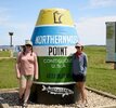
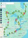
Anyone been to the Northwest Angle in Angle Inlet, MN? See you have to enter Canada for 30ish miles and the last 20 miles on dirt? Just guessing the dirt road is contingent on weather as to condition. Thinking that might be somewhere to go and get a pic to go with the southernmost in Key West.
Anyone been there? Worth the trip?
Guessing you could cross in the am and be back the same day?
 
Looking a Google Maps there are a few water crossings. Looks dirt bike only. Worth a trip....NO. :thumb:
 
I'm kinda doubting that's the northern most point. I'm rather directional challenge myself but I looked a Google map. There are several streets shown going toward the top of the map and I think maps are usually posted with north straight up. Probably is the northern most town in the 48 States. I also don't think the buoy in Key West is the southern most point. Once again, Google maps shows a several roads that appear south of the buoy's location. But I'll buy their story and I have a picture some where of Uncle Phil, Bamarider, myself and a former STer fom Miami, Sal at the buoy about 25 years ago.
 
I'm kinda doubting that's the northern most point. I'm rather directional challenge myself but I looked a Google map. There are several streets shown going toward the top of the map and I think maps are usually posted with north straight up. Probably is the northern most town in the 48 States. I also don't think the buoy in Key West is the southern most point. Once again, Google maps shows a several roads that appear south of the buoy's location. But I'll buy their story and I have a picture some where of Uncle Phil, Bamarider, myself and a former STer fom Miami, Sal at the buoy about 25 years ago.
it's a generalizations type thing which I know you understand. We all speak in generalities don't we?

Generally "Angle Inlet" is the area (of the contiguous USA as it says right on it) hence the monolith "buoy" thingy.

Generally "About 25 years ago" is the day you got the pic at the southern most point buoy. And if you look at google map closer you'll see everything to the south of the southern most point (thingy at key West) is a military base which is not quite where they want tourists snapping snappy pictures. You ever notice that big black steel slat fence in most of the southern point buoy pics? That's on base property.

About that buoy thing "at the buoy" you have a pic of....HAHA sometimes it just about the ride or drive generally.
 
Back
Top Bottom