A brief Resume of the good and interesting features of the XT
- Very bright screen.
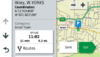
- Can navigate routes with spoken directions
- Can follow tracks with assitance to show distance and direction to closest point, if you deviate
- Can convert a track into a 'trip' and follow it with spoken directions, will not alter the original, but it will navigate you to the closest point
- Free 'Drive' App links smartphone to Zumo for weather, traffic, various notifications from phone (optional and configurable)
- Ability to email gpx files to the XT via the smartphone. Or drag and drop if using an Ios / android smart device for route planning (eg MRA)
- Built in track recorder (in addition to automatic track logging from earlier Zumos).
- MP3 Player will access MP3 files stored on XT. Also access to extrenal files via Bluetooth.
- PhotoLive images of major junctions on route ahead - see traffic build up.
- Ability to display 3D ampping with satellite imagery.
- The ability to group tracks, routes, Waypoints together into collections and then turn on just the resources you need for one days ride. Helps to keep the screen free of yesterday's clutter.
- When starting a route, the XT has the option of choosing the next destination (from a list of any via points int he route). But it also has 'Closest Entry Point'. Which measn it will find the point on the route that is closest to your current position, plot a route to that closest point and then follow all of the shaping points and via points in order. This is a brilliant feature which means that no matter what the XT throws at you, you can stop the route and restart it, selecting Closest Entry Point.
At additional cost
- Control wireless camera
- Control Garmin's Power Switch to control power to accessories
- Links with Garmin's InReach device - for two way text messaging, satellite tracking, Interactive SOS. Intended for off road users out of range of phone signals.
'Interesting' features
- Routing seems to require many more shaping points to force routing along the roads you wish to ride.
- 'Faster' routing seems to be achieved by heading for major roads - which may result in a longer time as it may detour to the nearest major road, rather than taking a perfectly good B road.
- It is more likely to recalculate the original route than previous Zumos. It monitors riding style, traffic info (which it can obtain without a smartphone), riding history. Now if it recalculates, it will recalculate every section of route between routing points rater than just the current section. This can take some getting used to.
- Garmin have an on-line mapping roesource - which is nothing like as good as Basecamp or MRA (in my opinion). But it will synchronise almost immediately with the Zumo XT. Put a waypoint onto the Explore site. It appears in the XT Favourites - with the same coloured icons that were used on Explore. The PC based version doesn not yet follow roads, but you can build routes with straight lines, which the XT can process and navigate. The ios and android app versions can now follow roads (and tracks and footpaths) - so you have to be careful with that.
- There are circumstances where the XT can tie itself in knots wif you deviate from the plotted route. In certain circumstances it will insist on going back to the place that you left the route. In other situations it does what I expect - finds a new way to get to the next route point.
- The screen can become very touch sensitive - especially when it gets hot. It may react to your finger before you touch, or it may react to raindrops. For me this has happened a few times, but senstitivity is reduced when the units gets into cooler air, and raindrop issues often seem to be caused by a dirty screen or too many raindrops on the screen. Not a single drop. I have had no problems with the XT mounted on the dash under the screen.
What has disappeared.
- Spotify is no longer available as an app. It stopped working ont he 595 and was never fixed.
- Live tracking. The 595 had the ability to send a trace of your progress via your smartphone to a website, which you could share with friend and family. This is not available on the XT, but I am told it is possible if you purchase an InReach device and subscription.
- Tyre pressure monitoring
- Cables. There are no input, output, charging cables connected to the XT mount. All connections are implemented using BlueTooth. This means if you have a wired headset, like autocom, you need a BlueTooth Module that can provide stereo out put and microhone input.
- All phone controls are transferred to the XT - as in earlier Zumos. The Zumo has to be at the centre of the connected devices. If you want rider to pillion and rider to everything else, then I believe that you need a dual channel headset to allow this to happen.
Do I like it ? Yes I do. There are certain behaviours that I would not trust in an area compeltely unknown to me. But it has so many ways of helping that I can live with it.
So now, I plote a route, and I also create a track of the same route. I load them both intot he Zumo and display them both att he same time. If I deviate fromt he route, and the recalculation seems weird, I can follow the track instead.
Did I nearly throw it in the bin ? Oh yes.
Is it still mounted on my bike. Yes it is. (But so is my mount for the 590/5). I have stopped taking that with me now. I know how to make the XT give me the help that I want.