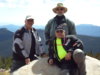
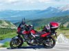
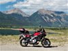
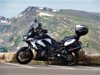
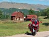
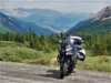
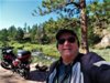
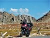
Day One of Overnight Colorado Ride. July 2022. V-Strom 650
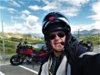
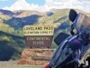
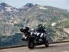
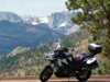
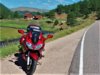
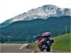
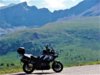
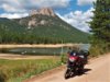
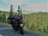
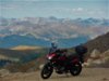
I just got back from an overnight 550 mile ride. Last week I had decided that I wanted to ride a few Colorado Passes that I have not ridden in a couple of years. But to do that I needed to do an overnight ride. All of my riding of late has been day rides, out and back and home in time for dinner. The Passes I had in mind were, Cottonwood Pass (12126 ft) out of Buena Vista, Kebler Pass, 31 miles of dirt,(9980 ft) out of Crested Butte, Independence Pass (12095ft) out of Aspen, and Loveland Pass (11990ft) out of Keystone, Colorado. These four were my target passes however the route I chose to ride took me over nine Colorado Passes total. The lowest being McClure Pass at 8763 ft and the highest being Independence Pass, the highest paved Pass in North America (12095ft). Yes there are higher passes in Colorado , but they are 4x4 dirt Passes. I will leave that for the younger crowd. BTDT in a previous life.
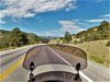
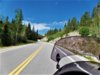
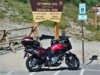
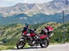
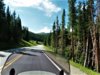
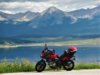
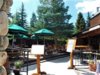
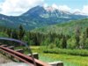
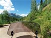
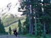
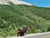
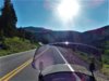
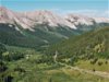
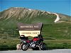
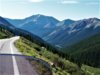
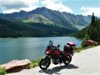
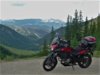
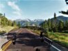
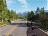
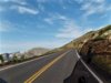
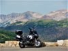
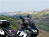
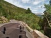
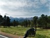
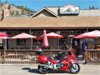
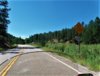
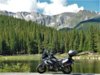
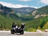
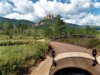
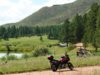
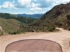
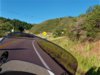
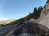
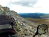
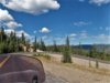
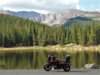
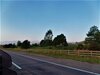
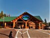
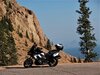
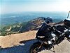
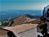
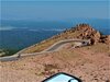
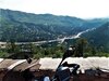
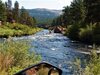
Day One’s route was to take me down to Deckers and south along route 67 to Woodland Park. A nice twisty scenic road that climbs out of the valley to 843ft, before turning west onto highway 24 to traverse Light Pass (9165ft) and Wilkerson Pass (9502ft). This is a nice scenic route through the Pass until dropping down the mountain into South Park. Then it is just a straight road across South Park to Highway 285. There it climbs up Trout Pass (9346ft) and descend to Buena Vista (7955ft) at the base of Cottonwood Pass. It was time to take a short break and gas up, as it was 150 miles from my departure. Wanted to make sure I had enough gas for the rest of the day. Cottonwood Pass (12126ft), my first objective of this trip. Cottonwood is a beautiful ride, the East side of the pass has some excellent pavement (for Colorado), with some high speed sweepers on the lower end, and some tight hairpin turns as the road gets higher. The West side of the pass used to be dirt and gravel dropping down to Tayler Park Reservoir. It was paved about three years ago and now is a beautiful leisurely ride down the mountain. Although I do miss some of the adventure of riding the dirt down to the reservoir. From there the road passes through Tayler Canyon runs along the Tayler River, Forrest Rd 742. A very scenic ride, to Almont. There I stopped for lunch at the Three Rivers Resort. Nice place with outside dinning, and a good Bacon Burger.
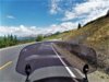
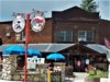
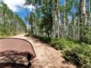
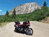
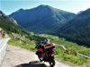
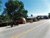
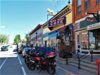
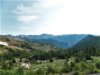
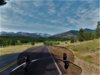
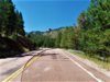
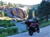
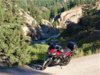
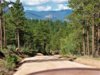
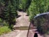
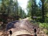
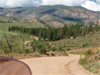
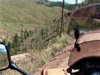
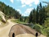
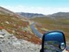
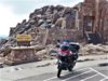
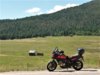
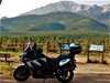
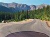
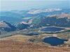
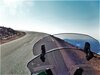
After Lunch rode into Crested Butte(8908ft). Highway 135 is flat and straight. No big surprises along the route. The scenery is nice and the view into Crested Butte is beautiful, with the mountains behind it. No other paved way out of Crested Butte except retracing back down 135. All other routes north or west are 4x4 trails or Kebler Pass dirt road. Crested Butte, 25 to 30 years ago was a small artsy/hippy town, but progress has discovered it. New vacation condos and town homes are springing up along the route into town. Traffic is max out and tourist are everywhere. Of course it is the middle of July / tourist season. The road over Kebler Pass (9980ft)is listed on the maps as unpaved county highway 12. 35 miles of easy non-technical dirt and gravel. One has to be careful and stay to the right as a lot of cars traverse this road during tourist season. However if the road is wet or the C-Dot is spreading mag-chloride on the road, it is quite slippery and has Pucker-Power potential. Today the road was dry with about half of it covered in fresh gravel. It was like riding on marbles.
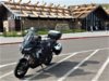
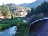
Up over the Pass down the other side and Objective two was met and completed today. Turned right on state highway 133 at Paonia State Park(6500ft) and head for McClure Pass. (8793ft) on the way to Carbondale for the end of day one. Unfortunately the hotel I wanted to stay at was full and the Comfort Inn next door wanted 300 bucks for a night. So I rode into Glenwood Springs and found a mom and pop motel for about half the price. Everything is expensive now days, especially during tourist season in Colorado. Stay tuned for Day Two of my overnight loop through Colorado. Total miles for the day 330 miles, total time 9 hours.
https://goo.gl/maps/TJTxsbQm1idARhTLA