


California represents the final leg of Route 66, where the Mother Road meets the Pacific Ocean after nearly 2,500 miles across America. Covering roughly 316 miles from the Arizona border to Santa Monica, this final stretch delivers one of the most dramatic transformations on the entire route, from empty desert to urban sprawl to the edge of the sea.
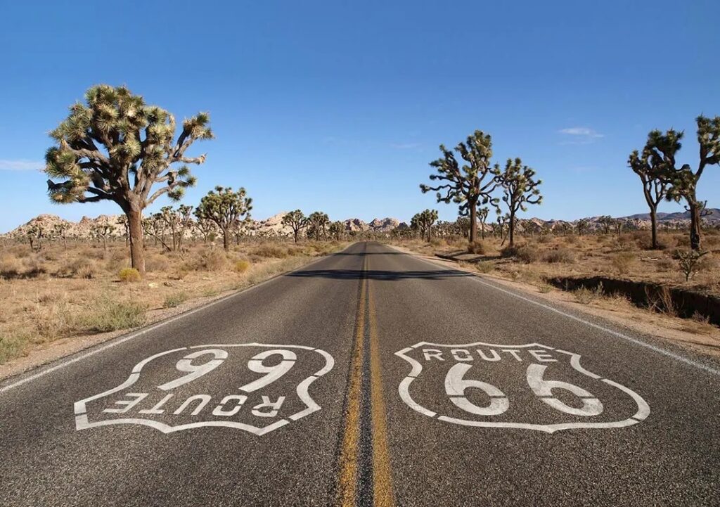
For many travelers, California was never just the end point. During the Dust Bowl and Great Depression of the 1930s, Route 66 became the “Road of Hope,” carrying thousands of families west in search of work, stability, and a new beginning. California’s agricultural valleys and expanding cities represented the promise of survival and reinvention. In that sense, the highway didn’t just end here; it fulfilled its original purpose.
Today, that journey begins in the Mojave Desert, where Route 66 enters California in a landscape defined by heat, silence, and space. Long, open stretches of highway cut through a harsh but striking environment, where remnants of the old road still survive. Towns like Needles, Amboy, and Barstow preserve fragments of the past with weathered motels, abandoned service stations, and roadside relics that speak to a different era of travel. Landmarks such as Roy’s Motel & Café and the stark volcanic landscape of Amboy Crater capture the feeling of isolation that once defined long-distance road travel across the Southwest.
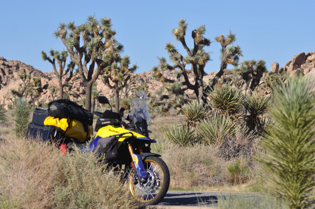
Joshua Trees are plentiful as you make your way through the desert.
As riders continue west, the desert slowly gives way to foothills and then the dense urban fabric of Southern California. The shift is sudden and striking where quiet highways are replaced by traffic, small towns replaced by cities, and open sky replaced by layers of movement and sound. Route 66 threads directly into this transformation, eventually merging into the greater Los Angeles region, where its historic path becomes part of everyday city life.
The journey culminates at Santa Monica Pier, the symbolic western terminus of Route 66. Marked by the famous “End of the Trail” sign, it has become a pilgrimage site for travelers who have crossed the continent. After miles of desert, plains, and mountains, the sight of the Pacific Ocean carries a sense of arrival that is both physical and emotional.
Beyond the pier, Santa Monica and nearby Venice Beach offer a final taste of coastal California with palm-lined streets, ocean air, and a blend of historic and modern culture. For those tracing Route 66 westbound, California is the end of the road. It’s the moment the journey resolves, where motion gives way to memory and the highway finally meets the coast.
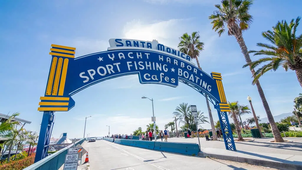
The end of Route 66 is on the Santa Monica Pier in Santa Monica, California.
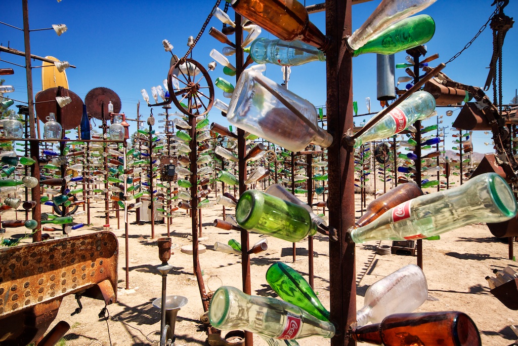
Elmer’s Bottle Tree Ranch in Oro Grande, California
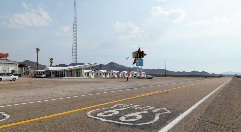
Roy’s Motel in Amboy, California
Location: Begins in Needles, ends in Santa Monica
Distance: 316 miles
Ride Time: 2 days
Best Direction to Ride: East to West for the true Route 66 experience
Skill Level: Beginner to Intermediate
Best Bike Type: Any motorcycle
Click to view California Route 66 on REVER
Click here to download the GPS files
California’s Route 66 is a mix of desert highway, old alignment fragments, and modern highway connectors. Surface conditions vary widely, from smooth paved desert straightaways to broken, patched, and weather-worn sections of original Route 66 pavement. Expect long, exposed straights through the Mojave, occasional rough or abandoned segments, and heavy traffic as you approach the Los Angeles basin. Hazards include crosswinds in open desert, sand drifting onto the roadway, heat shimmer, and urban congestion near Barstow, San Bernardino, and Los Angeles. Speed enforcement increases significantly near populated areas.
The best riding seasons are spring (March-May) and fall (September-November), when desert temperatures are manageable and skies are typically clear. Summer can be extremely hot in the Mojave, with temperatures exceeding 110 degrees, making midday riding dangerous without proper hydration and heat protection. Winter brings cooler desert conditions but can include high winds and occasional storms in mountain-adjacent areas. Traffic increases near holidays and weekends, especially approaching Los Angeles and Santa Monica. Cell service is generally reliable except in remote Mojave stretches, where long gaps still exist.
California’s Route 66 food scene is rooted in classic roadside Americana. In the desert, stops like the historic Bagdad Café in Newberry Springs offer a true Route 66 atmosphere and while they aren’t serving food as of this article publishing, they plan to reopen in the future. You can still grab a cold drink and talk to the owners. Barstow provides classic burger stands and old-school fast food stops. In Yermo, don’t miss stopping at Peggy Sue’s for a classic 50s diner experience. They serve one heck of a BLT. San Bernardino reflects the early fast-food history of the country, including the original McDonald’s site. As you near the coast, Santa Monica and Los Angeles offer endless options, from taco stands and food trucks to coastal seafood spots overlooking the Pacific. Don’t forget to grab a corn dog and walk the pier.
In the desert, Needles and Barstow offer practical roadside motels – nothing fancy, but a nice, cool, and clean place to stay. Victorville and San Bernardino offer more reliable hotel chains and restored Route 66-themed stays. The Wig Wam Motel in San Bernardino is one you don’t want to miss. As riders approach the coast, Santa Monica provides everything from historic boutique hotels to high-end oceanfront stays, making it the most comfortable, but also most expensive, stop on the route.
For the list of 100+ best roadside attractions along Route 66, click here.
If you’re extending your California Route 66 journey, the surrounding region offers some of the most iconic riding in the country. From Barstow, riders can connect south toward Angeles National Forest for mountain switchbacks and cooler air, or head west into Los Angeles and continue onto the Pacific Coast Highway for a coastal extension of the journey. To the north, the high desert opens into vast, empty riding through the Mojave National Preserve and toward Death Valley’s outer edges. Not far from Barstow you’ll find Big Bear, with its cooler temperatures, and fun twisties. It’s a great detour from Route 66, and offers up good food, a fun small town feel, and a chance to take a dip in the cold lake waters. For many riders, California’s section of Route 66 naturally expands into a broader exploration of the American West.
The post California Route 66—The End of the Road appeared first on Rider Magazine.
Continue reading...
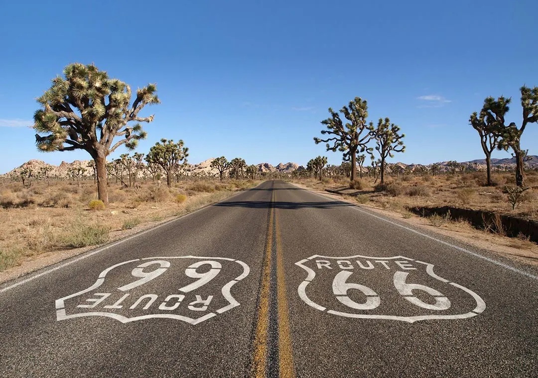
For many travelers, California was never just the end point. During the Dust Bowl and Great Depression of the 1930s, Route 66 became the “Road of Hope,” carrying thousands of families west in search of work, stability, and a new beginning. California’s agricultural valleys and expanding cities represented the promise of survival and reinvention. In that sense, the highway didn’t just end here; it fulfilled its original purpose.
Today, that journey begins in the Mojave Desert, where Route 66 enters California in a landscape defined by heat, silence, and space. Long, open stretches of highway cut through a harsh but striking environment, where remnants of the old road still survive. Towns like Needles, Amboy, and Barstow preserve fragments of the past with weathered motels, abandoned service stations, and roadside relics that speak to a different era of travel. Landmarks such as Roy’s Motel & Café and the stark volcanic landscape of Amboy Crater capture the feeling of isolation that once defined long-distance road travel across the Southwest.
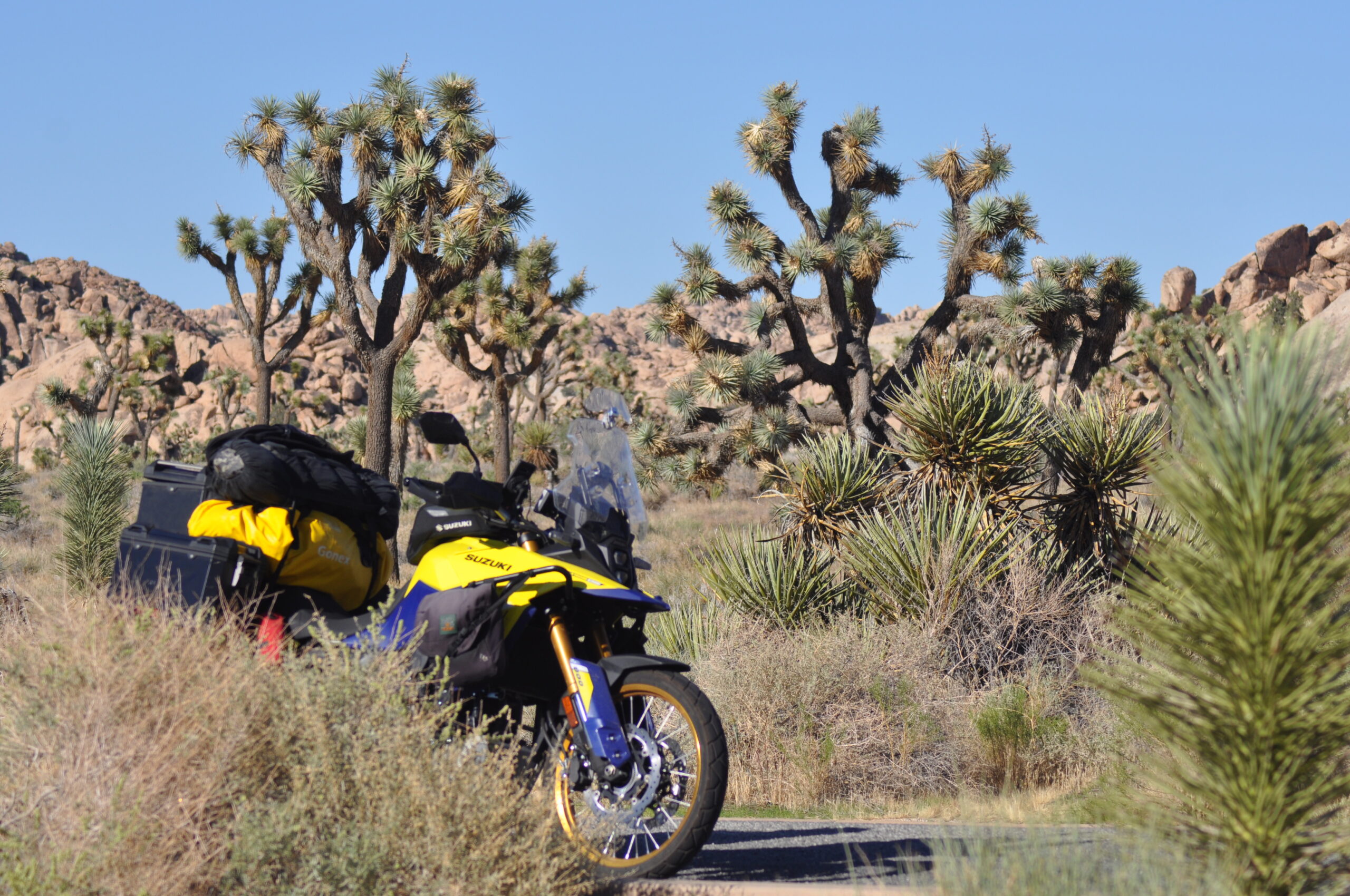
Joshua Trees are plentiful as you make your way through the desert.
As riders continue west, the desert slowly gives way to foothills and then the dense urban fabric of Southern California. The shift is sudden and striking where quiet highways are replaced by traffic, small towns replaced by cities, and open sky replaced by layers of movement and sound. Route 66 threads directly into this transformation, eventually merging into the greater Los Angeles region, where its historic path becomes part of everyday city life.
The journey culminates at Santa Monica Pier, the symbolic western terminus of Route 66. Marked by the famous “End of the Trail” sign, it has become a pilgrimage site for travelers who have crossed the continent. After miles of desert, plains, and mountains, the sight of the Pacific Ocean carries a sense of arrival that is both physical and emotional.
Beyond the pier, Santa Monica and nearby Venice Beach offer a final taste of coastal California with palm-lined streets, ocean air, and a blend of historic and modern culture. For those tracing Route 66 westbound, California is the end of the road. It’s the moment the journey resolves, where motion gives way to memory and the highway finally meets the coast.
The end of Route 66 is on the Santa Monica Pier in Santa Monica, California.
Elmer’s Bottle Tree Ranch in Oro Grande, California
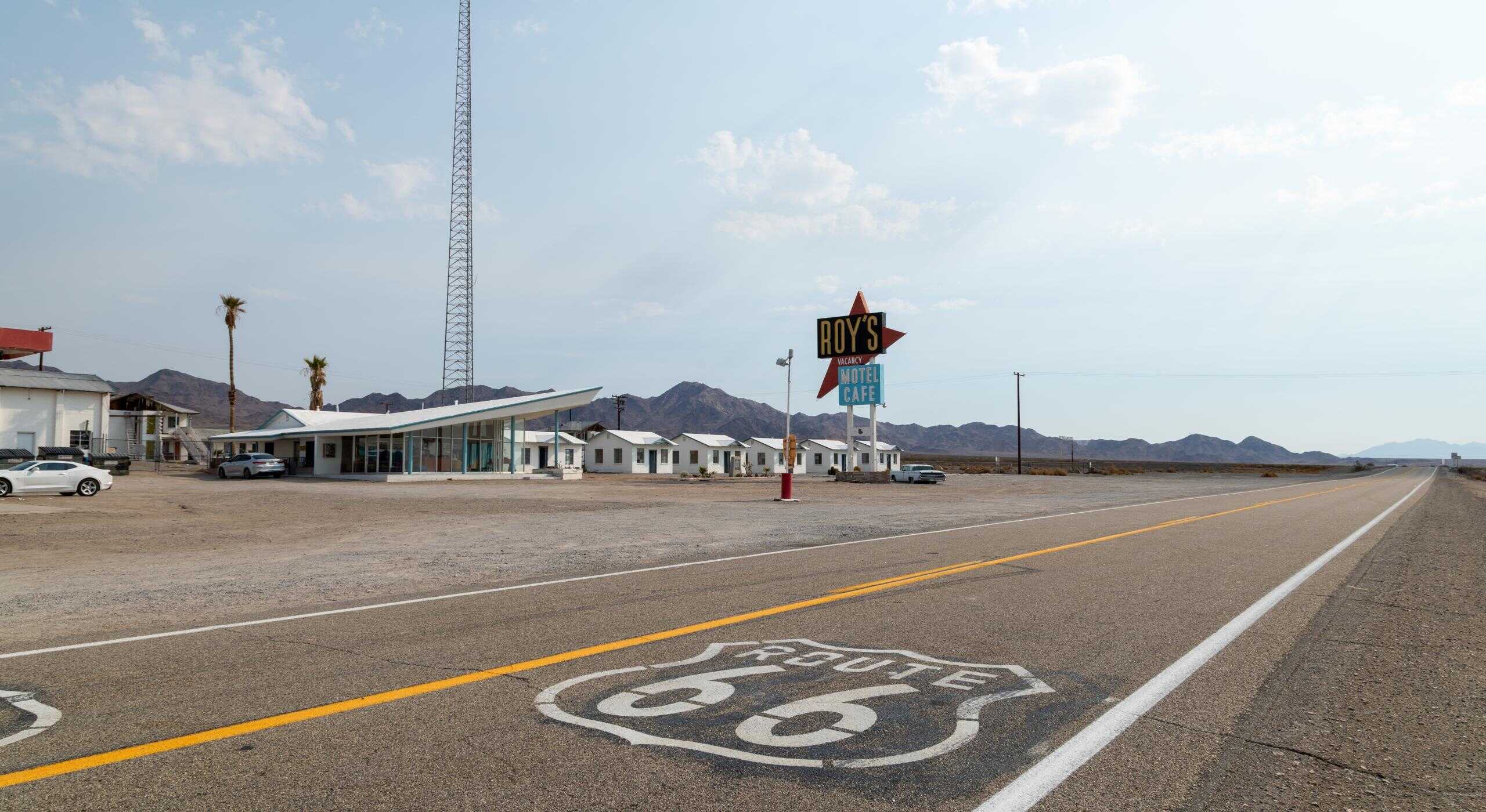
Roy’s Motel in Amboy, California
California Route 66 Travel Resources
At a Glance
Location: Begins in Needles, ends in Santa Monica
Distance: 316 miles
Ride Time: 2 days
Best Direction to Ride: East to West for the true Route 66 experience
Skill Level: Beginner to Intermediate
Best Bike Type: Any motorcycle
Maps & Routes
<iframe src="https://www.google.com/maps/d/embed?mid=114DOu9KbW2IseZVlZdDkgoB0MV5T4cA&ehbc=2E312F&noprof=1" width="640" height="480"></iframe>Click to view California Route 66 on REVER
Click here to download the GPS files
Road Conditions
California’s Route 66 is a mix of desert highway, old alignment fragments, and modern highway connectors. Surface conditions vary widely, from smooth paved desert straightaways to broken, patched, and weather-worn sections of original Route 66 pavement. Expect long, exposed straights through the Mojave, occasional rough or abandoned segments, and heavy traffic as you approach the Los Angeles basin. Hazards include crosswinds in open desert, sand drifting onto the roadway, heat shimmer, and urban congestion near Barstow, San Bernardino, and Los Angeles. Speed enforcement increases significantly near populated areas.
Best Time to Travel
The best riding seasons are spring (March-May) and fall (September-November), when desert temperatures are manageable and skies are typically clear. Summer can be extremely hot in the Mojave, with temperatures exceeding 110 degrees, making midday riding dangerous without proper hydration and heat protection. Winter brings cooler desert conditions but can include high winds and occasional storms in mountain-adjacent areas. Traffic increases near holidays and weekends, especially approaching Los Angeles and Santa Monica. Cell service is generally reliable except in remote Mojave stretches, where long gaps still exist.
Road Food
California’s Route 66 food scene is rooted in classic roadside Americana. In the desert, stops like the historic Bagdad Café in Newberry Springs offer a true Route 66 atmosphere and while they aren’t serving food as of this article publishing, they plan to reopen in the future. You can still grab a cold drink and talk to the owners. Barstow provides classic burger stands and old-school fast food stops. In Yermo, don’t miss stopping at Peggy Sue’s for a classic 50s diner experience. They serve one heck of a BLT. San Bernardino reflects the early fast-food history of the country, including the original McDonald’s site. As you near the coast, Santa Monica and Los Angeles offer endless options, from taco stands and food trucks to coastal seafood spots overlooking the Pacific. Don’t forget to grab a corn dog and walk the pier.
Nearby Lodging
In the desert, Needles and Barstow offer practical roadside motels – nothing fancy, but a nice, cool, and clean place to stay. Victorville and San Bernardino offer more reliable hotel chains and restored Route 66-themed stays. The Wig Wam Motel in San Bernardino is one you don’t want to miss. As riders approach the coast, Santa Monica provides everything from historic boutique hotels to high-end oceanfront stays, making it the most comfortable, but also most expensive, stop on the route.
Points of Interest
- Roy’s Motel & Café
- Amboy Crater
- Bagdad Cafe
- Elmer’s Bottle Tree Ranch
- Route 66 Museum
- Original McDonald’s Site and Museum
- Santa Monica Pier
- Mojave Desert open stretches and historic alignment segments
- Historic Route 66 roadside ruins between Needles and Barstow
- Los Angeles County Route 66 urban corridor
For the list of 100+ best roadside attractions along Route 66, click here.
If You Have More Time
If you’re extending your California Route 66 journey, the surrounding region offers some of the most iconic riding in the country. From Barstow, riders can connect south toward Angeles National Forest for mountain switchbacks and cooler air, or head west into Los Angeles and continue onto the Pacific Coast Highway for a coastal extension of the journey. To the north, the high desert opens into vast, empty riding through the Mojave National Preserve and toward Death Valley’s outer edges. Not far from Barstow you’ll find Big Bear, with its cooler temperatures, and fun twisties. It’s a great detour from Route 66, and offers up good food, a fun small town feel, and a chance to take a dip in the cold lake waters. For many riders, California’s section of Route 66 naturally expands into a broader exploration of the American West.
Resources
- National Park Service – Route 66 Corridor Preservation Program
- California Historic Route 66 Association
- Mojave National Preserve official information
The post California Route 66—The End of the Road appeared first on Rider Magazine.
Continue reading...


