• A to Z Rules
      Start with a City beginning with A
    1. This is BY STATE
    2. Similar to the Tag contest, there will be one thread per state
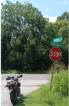
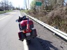
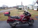
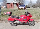
    3. Post a picture of your bike AND some sign, building etc which clearly shows the city/state you're in
    4. The next person posts from a city with the name beginning with B, then C, D, etc
    5. You can't posts back-to-back pics, you have to wait for a person to post the next city
    6. Once Z is reached, the game starts over with A
    7. If your state doesn't have a city beginning with the next letter in sequence, it's okay to skip that letter
    8. If the location sits for more than one month, the person that posted that is open to move it to the next letter.Previously Rule 8
    9. For some States there are tough letters to find such as Q, W, X, Y, Z - in those cases it is acceptable to find anything with those letters in the name to keep the game moving.

    The World Wide game is a bit different as it is by whatever is considered a geographic type of regional category, state/province/village etc. and all those will be in the single World Wide A-Z topic.
  • ST-Owners and the event organizer(s) are not responsible for the actions taken during any ride. Each member is responsible for determining if conditions are acceptable for riding and for their actions.

TN: A to Z (Round 11)

Well, couldn't decide which, so why not a 2fer. They're only a few miles apart.

(V)esta

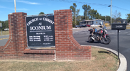
Vesta, Tennessee, is primarily recognized as a historic community and residential area in Wilson County, located near Lebanon. It is notably home to the Vesta Cedar Glade State Natural Area, a protected site for rare native flora, and is served by the historic Vesta Church of Christ. [1, 2, 3]

Nature & Recreation
  • Vesta Cedar Glade State Natural Area: This 150-acre site is part of the Cedars of Lebanon State Forest. It features unique karst topography with limestone outcroppings and sinkholes.
  • Rare Species: The area is a sanctuary for the Tennessee coneflower, which was once federally endangered. Other rare plants found here include the southern prairie dock and glade phlox.
Community & History
  • Vesta Church of Christ: One of the oldest churches in Wilson County, its roots date back to the mid-1800s. The original building was a one-room log cabin built in 1850.
  • Residential Neighborhood: The area around Vesta Road in Lebanon is described by Nextdoor as a quiet, residential neighborhood known for being friendly and peaceful, with an average resident age of 49.
1778184426316.png

(V)ine

The Community of Vine, TN
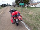
Vine is an unincorporated community located in Wilson County, approximately 13 miles south of Lebanon. [1]
  • Location: It sits along U.S. Route 231, SR 10, and SR 452.
  • Geography: Its unofficial boundaries are typically defined by the nearby communities of Gladeville to the west, Vesta to the north, Norene to the east, and Silver Hill (in Rutherford County) to the south.
  • Postal Service: Residents in Vine share the 37090 zip code with southern Wilson County. [1]
Also, according to the sign, home to Tennessee Hemp Consultants.

1778184488409.png
 
Walter Hill For W -
Walter Hill.jpg

A bit of History -

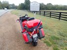
Walter Hill, Tennessee, is a historically significant, unincorporated community north of Murfreesboro on US 231, founded around 1790-1800. Initially known as Black’s Crossroads and Abbott’s Mill, it became a key agricultural hub, featuring the county’s first mills, school, and a historic 1804 dam site. The current name is from a local postmaster and storekeeper named Walter Hill, who operated in the area around 1895. He used his name on the postmark for the local post office, which became the identifier for the community.
 
Last edited:
Yorkville For A Y -
Yorkville.jpg

A Bit Of History -

Yorkville is located about fifteen miles northwest of Trenton and is in the Eighth Civil District of Gibson County. According to stories handed down Yorkville was first called Belt Buckle. No reason was known for this name. The village was first known as a "watering trough" where travelers could stop and water their stock. The watering trough was a huge container made of cypress and located near the main highway.
John C. Kuykendall, from Yorkville, South Carolina first settled there in 1830. Mr. Kuykendall built a home there and also a store and the town began flourishing. William Holmes located two miles south and others who followed were Reeds: Samuel, James, William, Robert and Hugh, Benjamin Tyson, Benjamin S. White and John W. Needham. By 1850 it was incorporated with W.H. Miller serving as the first mayor. Yorkville's greatest time of prosperity was probably between 1853 and up to the beginning of the Civil War.
 
MckenZie For A Z -
McKenzie.jpg

A Bit Of History -

Originally inhabited by the Chickasaw Indian Tribe, the first settlers started moving into this area during the early 1800s. In the original settling of what is now McKenzie, there were two families here that were "rivals". Each named the part of this towns area that they lived in a different name. One part of McKenzie was named Marrieta and the other part Dundas. It was still like this during the Civil War even though the community had much more to worry about at that time than the "rivalry' between the Sneads and the Gilberts. At that time there was a rather big family of McKenzie's that lived here. The city of McKenzie was organized in 1867 when the Nashville and Northwestern Railroad completed its track and intersected with the Memphis and Ohio Railroad. Its name was derived from the family that had previously owned the land where the railroads crossed. James Monroe McKenzie had given the property to the railroad company with the stipulation that his son George McKenzie be given the position of station agent for the Nashville, Chattanooga, and St. Louis Railroad. First known as McKenzie Station, it was soon shortened to McKenzie. The town began to develop rapidly after the tracks were completed and was officially incorporated by the state of Tennessee on January 22, 1869.
 
(A)dams Grove primarily refers to a prominent residential neighborhood and rural community area located in Lebanon, Wilson County, Tennessee. It sits within the broader Nashville metropolitan area. [1, 2, 3, 4]


Community Overview
  • Real Estate: The area features a mix of spacious, multi-acre single-family properties and upscale new construction projects. Homes in this neighborhood frequently range from $400,000 to over $1.2 million, showcasing expansive custom layouts and modern farmhouse aesthetics. [1, 2, 3]
  • Geography: Positioned southeast of downtown Lebanon, the community relies on major thoroughfares like Cainsville Road, Chicken Road, and SE Tater Peeler Road. [1, 2]
  • Setting: It blends the privacy of a quiet, rural landscape with accessible proximity to the commercial centers of Lebanon and nearby Mount Juliet. [1]
1785519584144.png
 
Brushy For B -
Brushy.jpg

A Bit Of History -

Brushy is a small rural community centered around Brushy Road in Hickman County, located roughly 3 miles southeast of Centerville, Tennessee. Its history is tied to rural settlement, early log-cabin schools, and local faith congregations. The community established its spiritual and educational roots when the Brushy Church of Christ began meeting in a one-room log cabin on Brushy Road in 1892. The original log cabin functioned as both a place of worship on Sundays and the local community schoolhouse during the weekdays. In 1908 local builders constructed a larger 40-by-22-foot weatherboard frame meeting house on Brushy Road (near the historic Tanner property) to accommodate a growing congregation of 40 to 50 regular attendees, which continued to serve educational needs. Unlike the industrial iron furnace operations or mineral springs resorts found elsewhere in Hickman County, Brushy developed primarily as a close-knit farming and residential settlement.
 
Looking for something close and found something interesting:

(C)ouchville

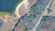
500' straight ahead to where Couchville used to be.
1786304708211.png

1786304062704.png

The old Couchville Pike runs through both lakes (Priest and Couchville)

1786304170091.png

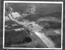
Submerged black community of Couchville, Tennessee
Titles are generated by AI from Meta

Submerged Heritage: Unearthing the Lost Black Community of Couchville, Tennessee, in Honor of Black History Month

As Black History Month unfolds, the story of Couchville, Tennessee—a once-thriving, self-sustaining Black community now lying beneath the waters of J. Percy Priest Lake—serves as a poignant reminder of resilience, land ownership, and the often-overlooked costs of progress. Founded in the post-emancipation era by free Black families and formerly enslaved individuals, Couchville exemplified early Black autonomy in the rural South, only to be erased in the 1960s through federal infrastructure projects that disproportionately displaced African American communities.
Couchville, located along the Stones River in Davidson County near present-day Mt. Juliet, was established before 1880 and featured a U.S. Post Office, farms, churches, and schools that fostered a close-knit society. Residents lived off the land, passing properties through generations and building institutions like Bryant’s Grove School, which operated from around 1880 to the 1940s on land donated by prominent Black families. This rural enclave was tied to figures such as Sherrod Bryant, a free person of color and one of the wealthiest Black men in Davidson County during the antebellum period. Bryant amassed significant land holdings, which he divided among his children from two marriages.
The community's heart was Bryant’s Grove, named after Sherrod Bryant's descendants, situated in Rutherford County but extending into Davidson along Couchville Pike. Historical maps from 1871 show properties owned by Bryant's children, including Laurenzella Scott Bryant, John Bryant, Catherine Dungy, and Sarah Bryant, clustered along McCrory Creek near what was then Chicken Pike (now Elm Hill Pike). By 1926, these lands had evolved, with roads like Combs Road (today's Couchville Pike) running through the area, supporting a vibrant Black neighborhood complete with a cemetery—potentially Nashville's oldest Black burial ground—a Rosenwald school, and a church that hosted community picnics and social gatherings.
Life in Couchville and Bryant’s Grove reflected the broader struggles and triumphs of Black Tennesseans in the Jim Crow era. Families farmed timber and grain, navigated floods from the Stones River, and educated their children despite systemic barriers. The Bryant’s Grove School, for instance, served as a beacon for Black education, drawing students from nearby areas after other schools were closed by county officials. Yet, this self-reliance was fragile. Incidents like the expulsion of the four Davis brothers from Bryanttown for mischief highlight the tight community bonds and the challenges of maintaining order in isolated rural settings.
The turning point came in the mid-1960s with the construction of the J. Percy Priest Dam by the U.S. Army Corps of Engineers, which impounded the Stones River to create a 42-mile-long reservoir for flood control, electricity generation, and recreation. Couchville, with fewer than 75 residents at the time, was inundated, forcing families to relocate as their homes, roads, and farmlands vanished underwater. Part of the community's main road still rests at the lake's bottom, a silent testament to what was lost. Bryant’s Grove was similarly devastated, with most of its Rutherford County portion submerged, disrupting generational wealth and cultural ties.
This displacement fits a larger pattern in U.S. history, where infrastructure developments like dams and lakes disproportionately affected Black and low-income communities. In Tennessee alone, similar fates befell towns like Loyston on Norris Lake, where residents—Black and white—were uprooted by the Tennessee Valley Authority. For Couchville, the loss was profound: thriving Black neighborhoods on Jefferson Street in Nashville were also decimated around the same time, compounding the erasure of Black spaces.
Today, echoes of Couchville endure in names like Couchville Cedar Glade State Natural Area and Couchville Recreation Area on Percy Priest Lake. A historical marker for Bryant’s Grove, relocated inside a park for better visibility, commemorates the community's legacy. Efforts to reclaim this history, such as the book "Under the Waters: History of the Lands and Communities Lost to the Impoundment of J. Percy Priest Lake," draw on personal recollections and archives to preserve stories of destruction and flooding.
In Black History Month 2026, reflecting on Couchville underscores the enduring fight for recognition of Black contributions and the injustices faced. As one social media commenter noted, "Before it was Percy Priest Lake it was farmland. And before that it was home." These submerged stories remind us that progress often comes at the expense of marginalized voices, urging a commitment to equity in future developments.

1786304344688.png
 
Duck River For D -
Duck River.jpg

Because of the Duck River river all history hits come up for the river not the community - which is on the Duck River. ;) The little bit I could find -
The "Duck River" post office in Hickman County, Tennessee, was historically established around 1833 (with early postmasters like James N. Bigham noted in 1850). Variations of the post office, including Duck River Furnace and Duckriver, operated intermittently across the 19th and 20th centuries.
 
Last edited:
(E)lmwood

The Famous Elmwood Mine
    • Elmwood became world-famous among mineral collectors for producing incredible crystal specimens, including rare calcite and fluorite.
    • It operated primarily as a zinc mine before closing permanently at the end of December 2023.

1787686889957.png
 
Flewellyn For F -
Flewellyn.jpg

A bit of history -

Flewellyn, Tennessee, located in Robertson County, is a historic rural community rooted in early 19th-century settlement. It is named for a Revolutionary War patriot William Flewellyn who was 22 years old in 1776 when he enlisted to fight in the Revolutionary War in Halifax County, N.C. He entered the service as a private for a term of two and a half years. He joined the Third Regiment of the North Carolina Continental Line, commanded by Colonel Jethro Sumner (for whom Sumner County, Tennessee is named). William, Jr. married Nancy Ann Branch of Halifax County, NC. They had four children. He and his family left Halifax County and arrived in Robertson County in 1797. This was about the time Robertson County’s new governing body had authorized the building of several roads and had legislated road crews to do the work. At that time, all able-bodied adult men were expected to work without pay to build roads along the land upon which they lived. In 1798, William Flewellyn was charged with overseeing the route being built from Miller’s Creek to Brown’s Fork on the road called Betts Road. According to court records, there were twelve workers on the crew. The name Flewellyn is derived from a Welsh term meaning "leader". The community was established by early settlers in the area, which later became known for its agricultural landscape. During the mid-19th century, this area served as a stop on the stagecoach route between Nashville and Clarksville.
St. Michael Catholic Church, dedicated on May 8, 1842, is the centerpiece of the community's history. The land was purchased from the nearby Wessyngton Estate for $5. It is known as Tennessee’s oldest in continuous operation. Father Abram Ryan, known as the "poet-priest" of the Confederacy, served at St. Michael from 1864 to 1865. The church was expanded in 1935 and celebrated its 100th anniversary in 1942. The St. Michael church and its surrounding property were entered into the National Register of Historic Places on August 10, 1973.
 
Henry For H -
Henry.jpg

A bit of history -

The smaller community of Henry developed primarily as a rural, agrarian settlement and railroad-adjacent locality within Henry County. Over the decades, Henry maintained its identity as a quiet residential and farming community. The town's claim to fame is it is the birthplace of renowned gospel singer Dr. Bobby Jones. Both the county and the town share a namesake in Patrick Henry, the famous American Revolutionary War patriot and orator from Virginia.
 
Back
Top Bottom