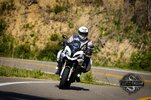
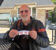
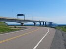
Where did you ride today?

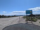
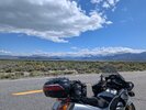
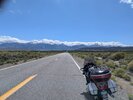
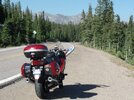
Rode out to Elk City, ID on Saturday to get a Roast Beast sandwich. Unfortunately, I had to ride 70 miles of this kind of road out there, and another 70 to get back. :( It was rough, but you know...somebody's got to do it.

1779122920068.png


Chris
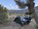
I slept East of town there for a few days when the surrounding was 100 degrees. great quite secluded spot. Ride in and out was fantastic. Wife said before you go again you will have a satellite tracker...

Screenshot 2026-05-18 at 7.24.20 PM.png
 
I slept East of town there for a few days when the surrounding was 100 degrees. great quite secluded spot. Ride in and out was fantastic. Wife said before you go again you will have a satellite tracker...

Screenshot 2026-05-18 at 7.24.20 PM.png
I bought a Delorme inReach SE years ago. Delorme sold out to Garmin. I really like it. Then there weren't many options. There's many more today. I do like the Delorme/Garmin inReach. Not only does it track my movements when I'm using it, it also includes the Earthmate app for free. It's great for anyone doing off-road hiking with topographic maps and tracking.

I bought it because many of the roads I travel on do not have cell phone coverage. I-90, that goes from Seattle to Albany, NY has cell phone coverage. But Hwy 2 over Stevens Pass has limited coverage. And even in the Seattle Metro area, High Bridge road doesn't have coverage. A biker went off the road years ago. There was no way to tell it had happened and his body and the bike were found 10 years later. And this is 25 minutes from my house. A satellite tracker is handy. There are lots of debates on where to carry the tracker...on the body or on the bike. I just tell my wife that if I don't check in, look for where the tracker has stopped.


There's another benefit for these. We're all getting older. My inReach SE has an SOS button where a signal can be sent to get help. I've never used it for myself, but almost did for a riding buddy of mine. He had a medical condition out on a trail and couldn't move. I was minutes away from pressing it when we got in touch with the park rangers.

Things may have changed, but a huge advantage of the Garmin trackers like the inReach SE is the ability to get two-way messaging. The SPOT transmitters only can send one-way. Why does it make a difference? Because the SPOT equipment has a large percentage of messages that never are received. If you're messaging for help, it is nice to know if someone got your help message.

Chris
 
Only 48 miles today. We’re little roasted after yesterday’s adventure. Road to Gatlinburg. Total tourist trap. The ride there was amazing. Mini Dragon. Came back and checked out Company Distillery. Enjoying some purchases while campground crew changes out my 30amp breaker. Here’s some pics. What an awesome area. 1000015557.jpegIMG_2427.jpegIMG_2425.jpeg
 
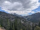
Just got home from a 2000 miles up and back from Nampa Idaho to see Uncle Larry. He is doing pretty good for an OLD GUY!!

The weather was pretty good going up there and on the way home there was a lot of wind and some light rain with temps dropping to 41 yesterday and 38 where I camped last night.

Here are a few pictures.
PXL_20260521_214927428.jpgPXL_20260521_223309496.jpgPXL_20260521_234046665.MP.jpgPXL_20260522_001626409.jpgPXL_20260522_004857854.MP.jpgPXL_20260522_011634785.jpgcaa0fb08-1627-4199-9801-10959782b2cf.jpgPXL_20260526_220900520.jpgPXL_20260526_222239669.jpgPXL_20260526_222249375.MP.jpgPXL_20260526_222302354.MP.jpgPXL_20260527_021445498.MP.jpgPXL_20260527_151902589.jpgPXL_20260527_152124223.jpg
 
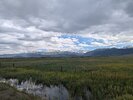
Just got home from a 2000 miles up and back from Nampa Idaho to see Uncle Larry. He is doing pretty good for an OLD GUY!!

The weather was pretty good going up there and on the way home there was a lot of wind and some light rain with temps dropping to 41 yesterday and 38 where I camped last night.

Here are a few pictures.
PXL_20260521_214927428.jpgPXL_20260521_223309496.jpgPXL_20260521_234046665.MP.jpgPXL_20260522_001626409.jpgPXL_20260522_004857854.MP.jpgPXL_20260522_011634785.jpgcaa0fb08-1627-4199-9801-10959782b2cf.jpgPXL_20260526_220900520.jpgPXL_20260526_222239669.jpgPXL_20260526_222249375.MP.jpgPXL_20260526_222302354.MP.jpgPXL_20260527_021445498.MP.jpgPXL_20260527_151902589.jpgPXL_20260527_152124223.jpg
Nice!
 
Spent the morning waiting for Bluestone. My father’s medical personnel that visit every month in his assisted living facility. Never showed. It’s lunchtime. Must go to lunch. Left him booking down the hallways to lunch. Went to Home Depot to pick up 20 bags of mulch. Unloaded them to staging area. Wife took her bike to her hair appointment. You know what. I will have some lunch and ride. 66 miles later, enjoying some libations on the patio. Still a great day. It included some riding. Sorry no pics.
 
The other end of the Mississippi -
The End Of The Line.jpg
Hard to read for all the stickers -
"Welcome - You have reached the southmost point in Louisiana" and the end of the GRR.
The real challenge was me and SweetTreat had to go wading to get there -
Wading.jpg
The water was up to the foot pegs in some of it (I watched a truck go through it first)
and parts of it was slicker than snot on a doorknob.
But I was 4/10 of a mile from the end and took a chance and made it through coming and going with only a pucker or two. ;)
 
Last edited:
The other end of the Mississippi -
The End Of The Line.jpg
Hard to read for all the stickers -
"Welcome - You have reached the southmost point in Louisiana" and the end of the GRR.
The real challenge was me and SweetTreat had to go wading to get there -
Wading.jpg
The water was up to the foot pegs in some of it (I watched a truck go through it first)
and parts of it was slicker than snot on a doorknob.
But I was 4/10 of a mile from the end and took a chance and made it through coming and going with only a pucker or two. ;)
I used to call on the gas plant at the end of that road. If you had told me you could go south from downtown New Orleans for 100 miles I would have not believed you. After Katrina we crossed the river and came up the east side. Katrina had flooded a cemetary and caskets and vaults were all over the road and levy. How do you straighten out that mess? Whose job is that? Everyone gets buried on top of the ground in that part of the world. Sure proud I didn't have an uncle Bud to try and identify.
 
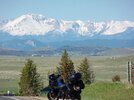
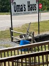
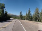
Rode the NT1100 down to Colorado Springs for a German Bakery run. Total miles 114 round trip. Came back on the Freeway I-25. Bike ran great with lots of torque to get around traffic.. More I ride this bike the better I like it. Have had now for just over a year.

SAM_8559.JPGSAM_8568.JPGSAM_8571.JPG
 
The other end of the Mississippi -
The End Of The Line.jpg
Hard to read for all the stickers -
"Welcome - You have reached the southmost point in Louisiana" and the end of the GRR.
The real challenge was me and SweetTreat had to go wading to get there -
Wading.jpg
The water was up to the foot pegs in some of it (I watched a truck go through it first)
and parts of it was slicker than snot on a doorknob.
But I was 4/10 of a mile from the end and took a chance and made it through coming and going with only a pucker or two. ;)
Well dang it. I rode 1/2 west to the Venice Marina a couple times and I didn't know that sign was down there closeby!!
 
Well dang it. I rode 1/2 west to the Venice Marina a couple times and I didn't know that sign was down there closeby!!
Just watch the water to get to the sign - it might flood into the floorboards of your Miata ... ;)
I found it on Google Earth labeled as 'The End Of The Line' when I was planning the ride.
 
Back
Top Bottom